Urban Activity Fingerprints · Visualisation of three western metropolises in terms of social interaction density · Anil Bawa-Cavia (2010)
[ large ]
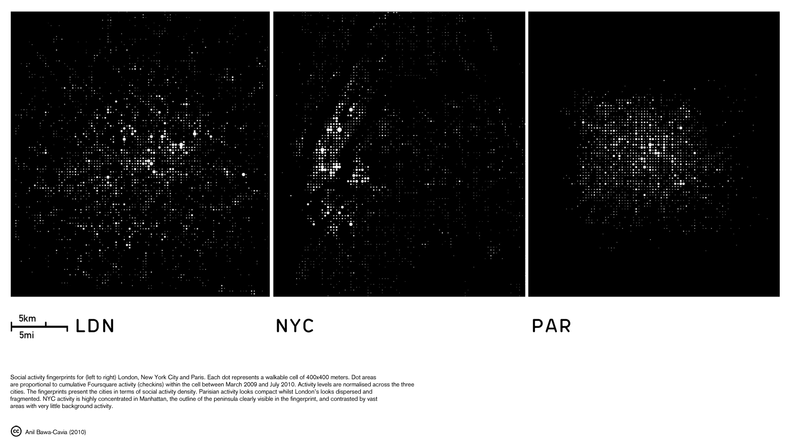
These urban activity fingerprints are produced from the aggregate activity of Foursquare users in New York City, London and Paris. They present the city in terms of social interaction density, summarising over 800,000 interactions across thousands of venues. Each dot represents a walkable cell of 400×400 meters. Dot areas are proportional to cumulative 4sq activity (checkins) within the cell between March 2009 and July 2010.
Parisian activity looks compact whilst London’s looks dispersed and fragmented. NYC activity is highly concentrated in Manhattan, the outline of the peninsula clearly visible in the fingerprint, and is contrasted by vast areas with very little background activity.
The demographic specificity of the Foursquare network should be considered when interpreting the aggregate data. In the UK, smartphone penetration is estimated at 26.5% of the population (Ofcom, 2010), whilst the global demographics of 4sq show a pronounced skew towards university educated 25-34 year olds and a small skew towards females (
Online social network data is potentially capable of revealing socio-spatial phenomena, such as sprawl or segregation. Parisian data falls away sharply beyond the péripherique ring road, meaning activity is contained to under a quarter of the unité urbaine, implying a deep segregation between the Foursquare network demographic and other groups in the wider city. Likewise sprawl can be considered in terms of low levels of interaction density or a scarcity of social venues.
See Also: archipelago, Real Time, Pervasive, Fragment