Boundary
Shapetiles
Aaron Straup Cope (2010) · Cartography using shapefiles induced from geotagged Flickr images.
[ source ]
Aaron Straup Cope (2010) · Cartography using shapefiles induced from geotagged Flickr images.
[ source ]
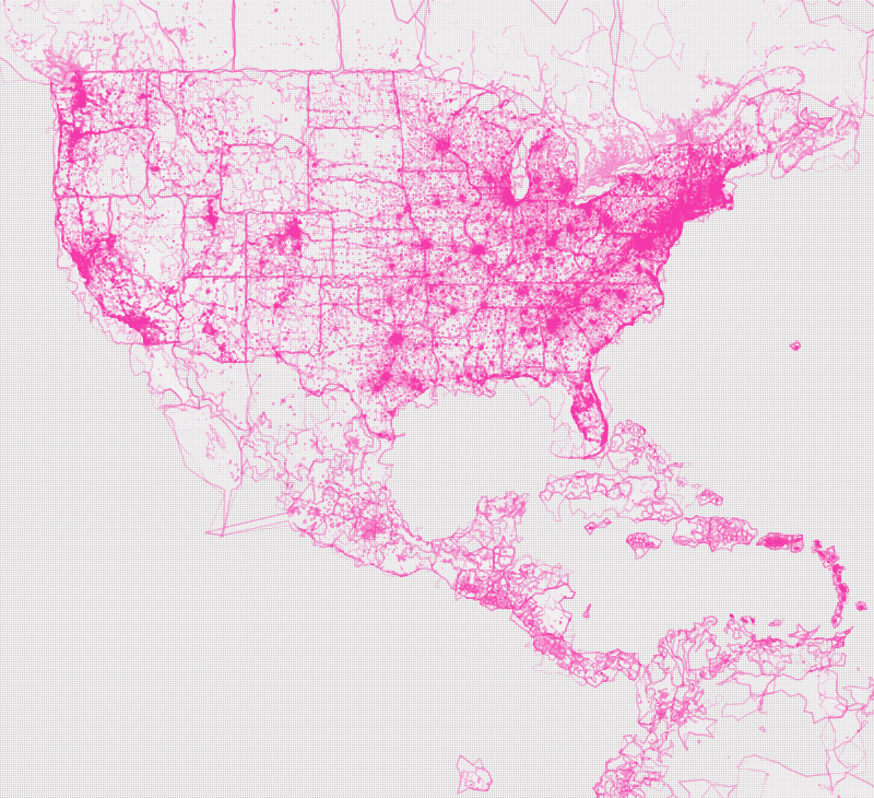
Shapetiles by Aaron Straup Cope is a crowdsourced map produced from millions of geotagged Flickr photos. Contours emerge from the mass of points, allowing for shapes to be detected from vast numbers of geo-located events. These intersecting shapefiles can then be visualised.
The emergent graphic shows the bounded shapes of neighbourhoods, cities, regions, nations, and continents, demonstrating how a rich image of the world can be constructed from the bottom up as the result of many individual photographic events.